In the early morning hours of February 26th, a massive earthquake (magnitude 7.5) hit about 200 miles west of Ukarumpa (our support center):
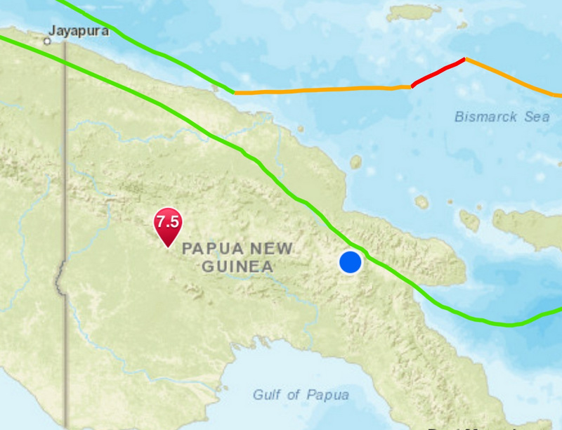
This is the biggest earthquake we’ve “seen” since coming to Papua New Guinea (PNG) in 2011. Thankfully, nobody in our organization was injured (we are safe!) and there was minimal damage to our infrastructure. The impact, however, was felt much more severely closer to the epicenter.
There have been well over 100 “aftershocks” close to the epicenter, all averaging about 5.0 in magnitude:

Somebody in the area at the time of the earthquake said there were minor aftershocks about every 10 minutes and a major aftershock about every hour.
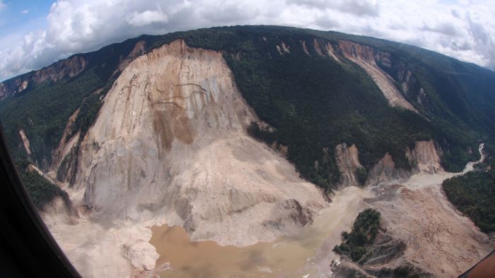
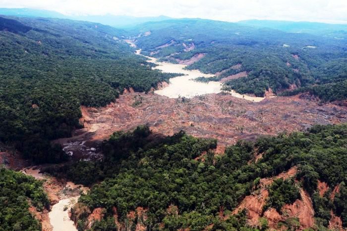
Because of the extremely steep terrain, there were countless landslides. Some were huge:
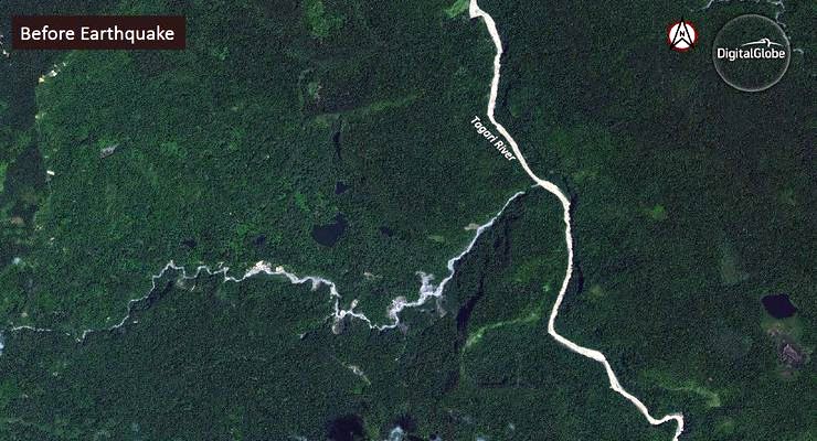
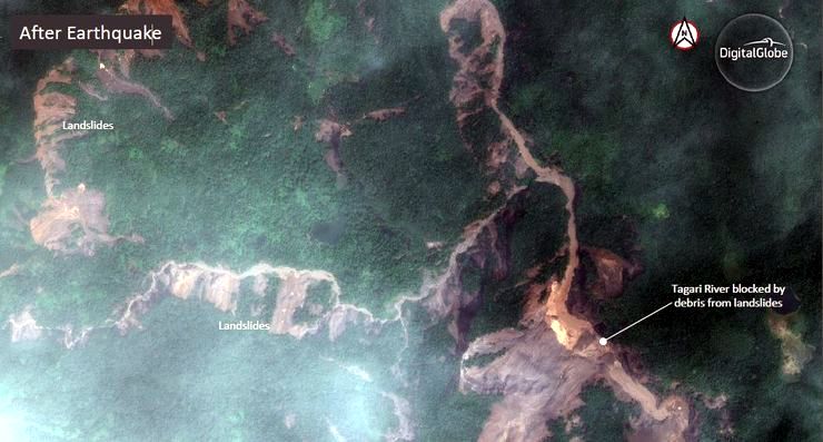
This area (around the Tagali River) gives an idea of the far-reaching effects and numerous landslides. Here is a satellite image from before the earthquake:
Below is the exact same area after the earthquake. You can see many, many large landslides, including where the river is completely blocked (in the lower-right corner):
The results are staggering, even more so in a picture from closer to the ground, where you can see the landslide that completely blocked the river:
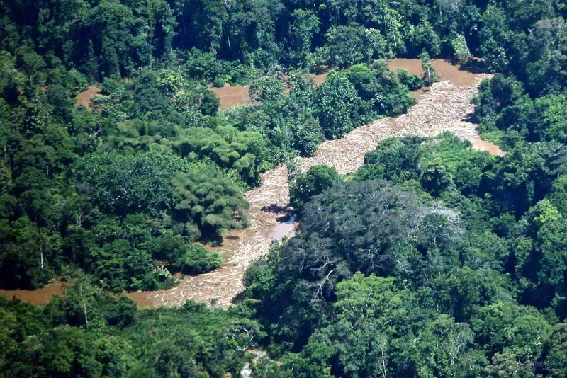
Many rivers are filled with mud and debris, which kills the fish (a source of food):
With landslides and floods like these all over the affected area, gardens have also been lost. Food and clean water is scare; people are really struggling, and they truly need our prayers.
The devastation went beyond rivers and gardens.
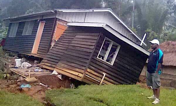
Houses were lost:
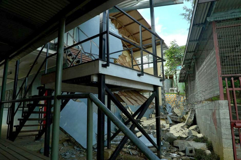
Buildings were damaged:
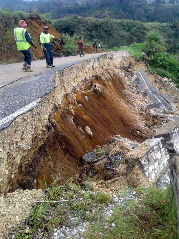
Roads have been wiped out:
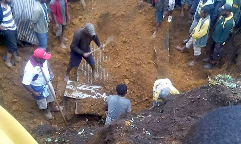
We have also heard the sad news that somewhere around 100 people have lost their lives due to this earthquake.
While the aftershocks have slowed down, the impact and need for prayer and support is still great.
If you are interested in donating to the relief efforts, we suggest a donation through MAF (Mission Aviation Fellowship):
- Go to https://www.maf.org/donate#ways-to-give
- Click on Where should your gift go?
- Choose the Disaster Response Fund.
- Choose how much you want to give
- Click on the additional options and write a comment that it is for PNG earthquake relief. Then it will get directed to MAF PNG for flights and supply deliveries.
Thank you for your continued prayers for the people of Papua New Guinea.
Leave a Reply